![]()
Expeditions A Mudrunner Game Map
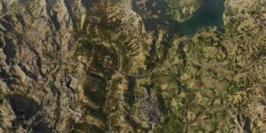
The Expeditions A Mudrunner Game Map provides comprehensive coverage of all nine distinct regions in this challenging off-road adventure. From the rocky terrain of Grand Canyon to the treacherous swamplands of Sliprock Swamps, this interactive mapping tool tracks every location, object, collectible, and mission across the vast wilderness. Each region presents unique environmental challenges that require careful navigation and resource management to overcome.
Navigation becomes crucial when traversing difficult terrain with heavy machinery and scientific equipment. The Expeditions A Mudrunner Game Map eliminates guesswork by marking essential waypoints, resource locations, and mission objectives throughout each area. Players can plan efficient routes, locate critical supplies, and identify optimal paths for their expeditions without getting lost in the expansive wilderness environments.
This mapping system proves invaluable for expedition planning and completion tracking. Whether searching for rare geological samples in the Dormant Volcano or navigating the complex cave systems of Mountain Labyrinths, having detailed geographic information saves hours of exploration time and prevents costly equipment losses due to poor route planning.
Maps Covered
The interactive mapping system encompasses nine interconnected expedition zones, each presenting distinct challenges and opportunities. Main Base serves as the central hub where expeditions begin and equipment gets upgraded between missions. Grand Canyon and Coconino offer desert environments with steep cliff faces and rocky outcroppings that test driving skills and vehicle durability.
Wahweap Bay introduces water-based obstacles and muddy shorelines, while Sonoran Desert expands the arid landscape with vast open spaces and hidden canyons. Mountain Labyrinths creates vertical challenges with winding paths and elevation changes that demand careful navigation. The remaining zones – Unshakable Island, Sliprock Swamps, and Dormant Volcano – each provide specialized terrain types that require different vehicle configurations and expedition strategies to successfully explore.
How to Use the Expeditions A Mudrunner Game Map
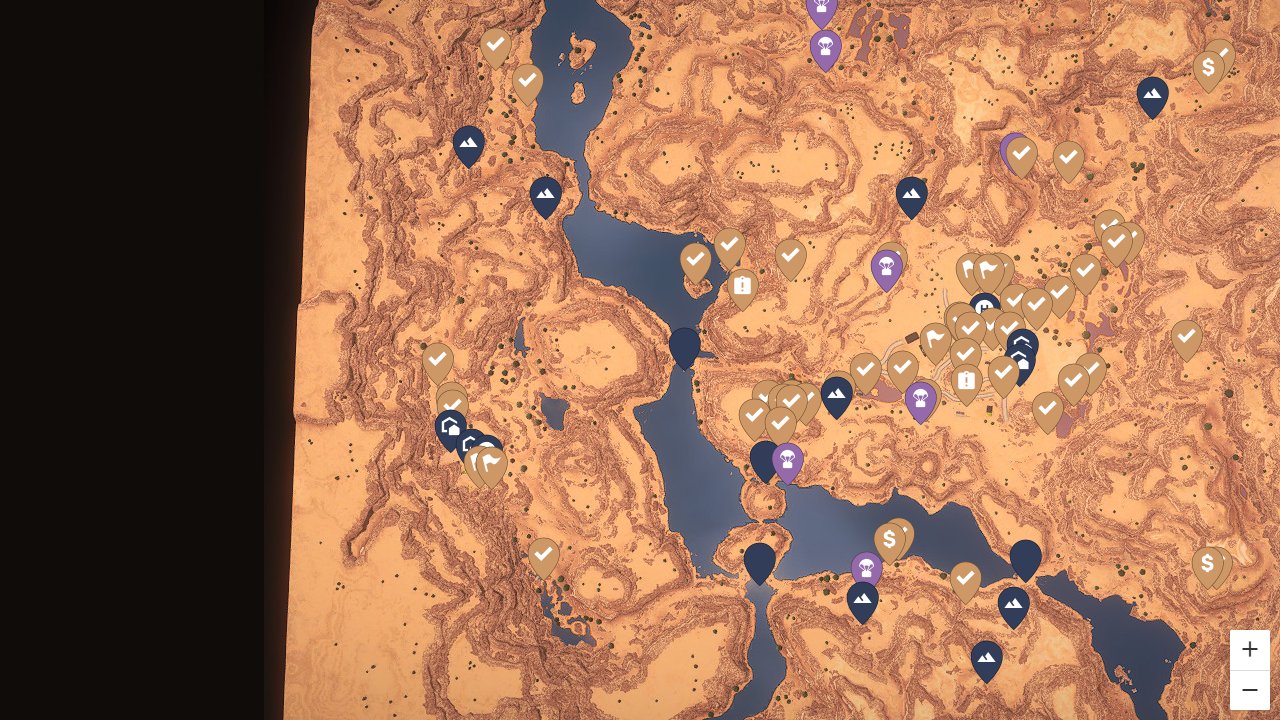
Locations and exploration markers highlight key geographical features, vehicle access points, and scenic viewpoints across all regions. These waypoints help identify safe camping spots, equipment drop zones, and areas suitable for different vehicle types. The system clearly distinguishes between accessible terrain for standard vehicles versus areas requiring specialized equipment or winching capabilities.
Objects and collectibles tracking covers scientific specimens, geological samples, and research materials scattered throughout each expedition zone. Mission markers integrate seamlessly with these collectible locations, showing how individual objectives connect to broader expedition goals. This organization allows players to combine multiple objectives into efficient exploration routes rather than making separate trips for each task.
Resource management becomes streamlined through markers indicating fuel stations, repair facilities, and supply caches positioned strategically across the wilderness. These essential services often determine expedition success or failure, making their locations critical information for route planning and emergency backup strategies.
What the Expeditions A Mudrunner Game Map Can Do
Optimize Vehicle Route Planning
The mapping system reveals optimal paths between objectives while highlighting terrain hazards that could damage vehicles or strand expeditions. Players can identify which routes require winching equipment, where alternative paths exist around obstacles, and which areas offer the most stable ground for heavy vehicle transit.
Track Scientific Collection Progress
Research objectives and specimen collection points receive detailed marking with progress indicators showing completed versus remaining items. This systematic approach prevents missed collections and ensures comprehensive coverage of each region’s scientific opportunities without redundant exploration.
Coordinate Multi-Stage Expeditions
Complex missions spanning multiple regions benefit from integrated planning tools that show supply line connections and staging areas. The map reveals how individual expedition phases connect, where equipment transfers occur, and which base facilities support different mission types across the various terrains.
Manage Equipment and Resource Distribution
Strategic resource placement becomes clear through markers showing fuel consumption zones, repair frequency areas, and equipment-specific challenges. This information helps determine optimal vehicle loadouts and supply distribution strategies for extended expeditions into remote regions.
Navigate Environmental Hazards
Dangerous terrain features receive specific marking to prevent vehicle damage and mission failure. The system identifies unstable ground, deep water crossings, steep inclines, and other hazards that require careful approach or specialized equipment to traverse safely.
Expeditions A Mudrunner Game Map Overview
A quick reference for the key features of this interactive map.
| Category | Example | Why It Matters |
|---|---|---|
| Locations | Research stations in Dormant Volcano | Identifies mission hubs and equipment upgrade facilities |
| Objects | Geological specimens in Mountain Labyrinths | Tracks collectible research materials for expedition completion |
| Collectibles | Rare mineral samples across all regions | Enables systematic collection without missing valuable discoveries |
| Missions | Multi-stage expeditions in Sliprock Swamps | Coordinates complex objectives across challenging terrain |
| Resources | Fuel depots and repair stations | Prevents expedition failure through strategic supply management |
Frequently Asked Questions
What does this Expeditions A Mudrunner Game map cover?
The map covers all nine expedition regions including Main Base, Grand Canyon, Coconino, Wahweap Bay, Sonoran Desert, Mountain Labyrinths, Unshakable Island, Sliprock Swamps, and Dormant Volcano. Each area includes complete marking of locations, objects, collectibles, and missions with detailed terrain information for expedition planning.
How does this map help with completion?
The mapping system tracks progress across all mission objectives and collectible items, showing completed versus remaining tasks. This prevents missed opportunities and ensures comprehensive exploration of each region without redundant travel or overlooked expedition goals.
Are collectibles included?
Yes, all collectible scientific specimens, geological samples, and research materials receive detailed marking across every expedition zone. The system organizes these items by type and region, making systematic collection efficient and comprehensive.
Does this map cover progression systems?
The mapping system integrates expedition progression by showing how missions connect across regions and which objectives unlock new areas or equipment. This helps players understand the overall expedition campaign structure and plan advancement strategies effectively.
Is this map complete?
The interactive mapping system provides comprehensive coverage of all current expedition content with regular updates to maintain accuracy. Every major location, mission objective, and collectible item receives proper marking and categorization across all nine expedition regions.
Credit: Expeditions A Mudrunner Game Map by MapGenie